Region
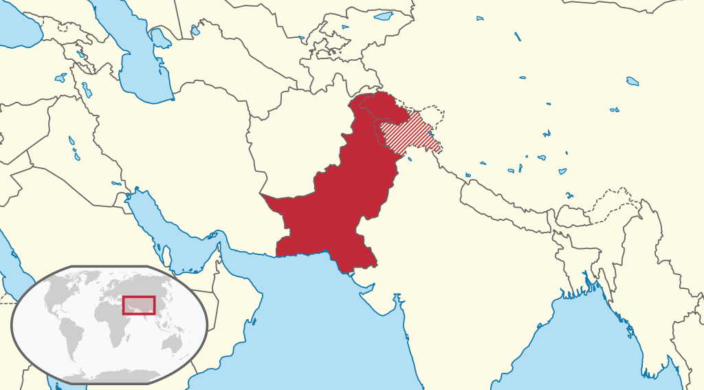
Pakistan is a large country (1.5 times the size of France) in South Asia at the crossroads of Central Asia, East Asia, and South Asia. Located along the Arabian Sea, it is surrounded by Afghanistan to the west and northwest, although Tajikistan is separated by the Wakhan Corridor, Iran to the southwest, and also shares a maritime boundary with Oman, The Republic of India is to the east, and China to the northeast. It is strategically located astride the ancient trade routes of the Khyber and Bolan passes between the countries of South-Central Asia and the rest of Southern Asia.

Azad Kashmir
Azad Kashmir abbreviated PAK (literally “Free Kashmir”) is the southernmost and the smaller of the two political entities which together constitute the Pakistani-controlled part of the former princely state of Jammu and Kashmir, which ceased to exist as a result of the First Kashmir War (1947) and Indo-Pakistani War of 1948. The northernmost and the larger of the two political entities is the Pakistani-controlled territory of Gilgit-Baltistan. Both PAK and Gilgit-Baltistan are self-governing political entities and, constitutionally, do not form liberated parts of Pakistan. For all practical purposes, though, both PAK and Gilgit-Baltistan act like parts of Pakistan.
Balochistan
Balochistan is one of the four provinces of Pakistan. It is the largest province in terms of land area, forming the southwestern region of the country, but it is the least populated. Its provincial capital and largest city are Quetta. Balochistan shares borders with Punjab and the Khyber Pakhtunkhwa to the northeast, Sindh to the east and southeast, the Arabian Sea to the south, Iran to the west and Afghanistan to the north and northwest.
Gilgit-Baltistan (formerly known as the Northern Areas)
Gilgit-Baltistan (formerly known as the Federally Administered Northern Areas or FANA) is the northernmost political entity within Pakistan. According to Pakistan’s constitution, Gilgit-Baltistan is a self-governing region under Pakistan. Gilgit-Baltistan is home to some of the world’s highest mountains, including five of the eight-thousanders. The main focus of attention for many travelers is the world’s three highest mountain ranges–the Karakoram, the Himalaya, and the Hindu Kush, with five peaks over 8,000 meters and many peaks over 7,000 meters, and has the largest glaciers in the world (other than those in the polar region). Wild rivers and unique landscapes make this area a “mountain paradise” for mountaineers, trekkers, and tourists.
Islamabad Capital Territory
Islamabad is the capital city of Pakistan and is federally administered as part of the Islamabad Capital Territory. Islamabad is the ninth-largest city in Pakistan, while the larger Islamabad-Rawalpindi metropolitan area is the country’s fourth-largest with a population of about 7.4 million. Built as a planned city in the 1960s to replace Karachi as Pakistan’s capital, Islamabad is noted for its high standards of living, safety, and abundant greenery. The city is the political seat of Pakistan and the local government setup is run by the Islamabad Metropolitan Corporation, supported by the Capital Development Authority (CDA).
Khyber Pakhtunkhwa (formerly known as the North-West Frontier Province)
Khyber Pakhtunkhwa offers an invitation to see a spectacular landscape and cultural diversity. Peshawar is the business and administrative hub of this province though other cities have their places. Some of the tourist hotspots include Khyber pass, old interior city, industrial estate famous for smuggled goods, Islamia College, Peshawar fort, (KisaKhawani) storyteller bazaar. Its food street is famous for barbecued sheep meat as well as karahi meat.
Punjab
Punjab is Pakistan’s second-largest province at 205,344 km² (79,284 sq mi²) after Balochistan and is located at the northwestern edge of the geologic Indian plate in South-Central Asia. The capital and largest city are Lahore which was the historical capital of the wider Punjab region. Nearly 60% of Pakistan’s population lives in Punjab. It is the nation’s only province that touches every other province; it also surrounds the federal enclave of the national capital city at Islamabad. This geographical position, and a large multi-ethnic population, strongly influence Punjab’s outlook on national affairs and induces in Punjab a keen awareness of the problems of Pakistan’s other important provinces and territories.

Sindh
Sindh is one of the four provinces of Pakistan. Known by various names in the past, the name Sindh comes from the Indo-Aryans whose legends claimed that the Indus River flowed from the mouth of a lion or Sinh-ka-bab. In Sanskrit, the province was dubbed Sindhu meaning “ocean”. The Assyrians (as early as the seventh century BCE) knew the region as Sinda, the Persians Abisind, the Greeks Sinthus, the Romans Sindus, the Chinese Sintow, while the Arabs dubbed it Sind. It is mentioned to be a part of Abhirrdesh (Abhira Kingdom) in Srimad Bhagavatam. Sindh was the first place where Islam spread in South Asia. As a result, it is often referred to as “Bab-al-Islam” (Gate of Islam). The provincial Pakistani region of Sindh covers an area of 54,407 mi² or (140,914 km²).


Comment (0)